Old-school mapping
 The digital mapping I've been doing is great, but it wasn't until I pulled out the Amtrak national route map and started putting Post-it arrows on it that my upcoming trip started to seem real.
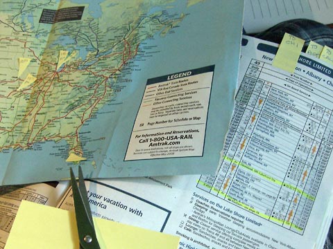
Yellow arrows on the map mark places I might visit. Tabs labeled "To Chicago" and "to Calif." help me find the schedule pages I need, and yellow highlighter shows arrival and departure times for specific cities.
I never got around to overlaying on the computer my online map of potential schools to visit with the locations of Amtrak stations, but with one map open on screen and the other in my lap it was easy enough to combine the two.
I've started sending emails to people who said "yes" or "maybe" to the survey question that asked if I might visit their schools as part of my sabbatical research project. In a day or two I should have a better idea of where I'll be going other than "the LA area" and "the Portland area," which is about as specific as I can be right now. Things are starting to come together. Lots more to do though.
![]() Any suggestions of schools I should visit? Other ideas? Add your comment by clicking below.
Any suggestions of schools I should visit? Other ideas? Add your comment by clicking below.
Top |
|
![]()